

Iran publishes map defining maritime transit zone in Strait of Hormuz
TEHRAN, May 21 (YPA) – Iran’s newly created Persian Gulf Strait Authority (PGSA) published a map defining a maritime transit zone that requires prior coordination and official authorization from the Islamic Republic of Iran for passage.
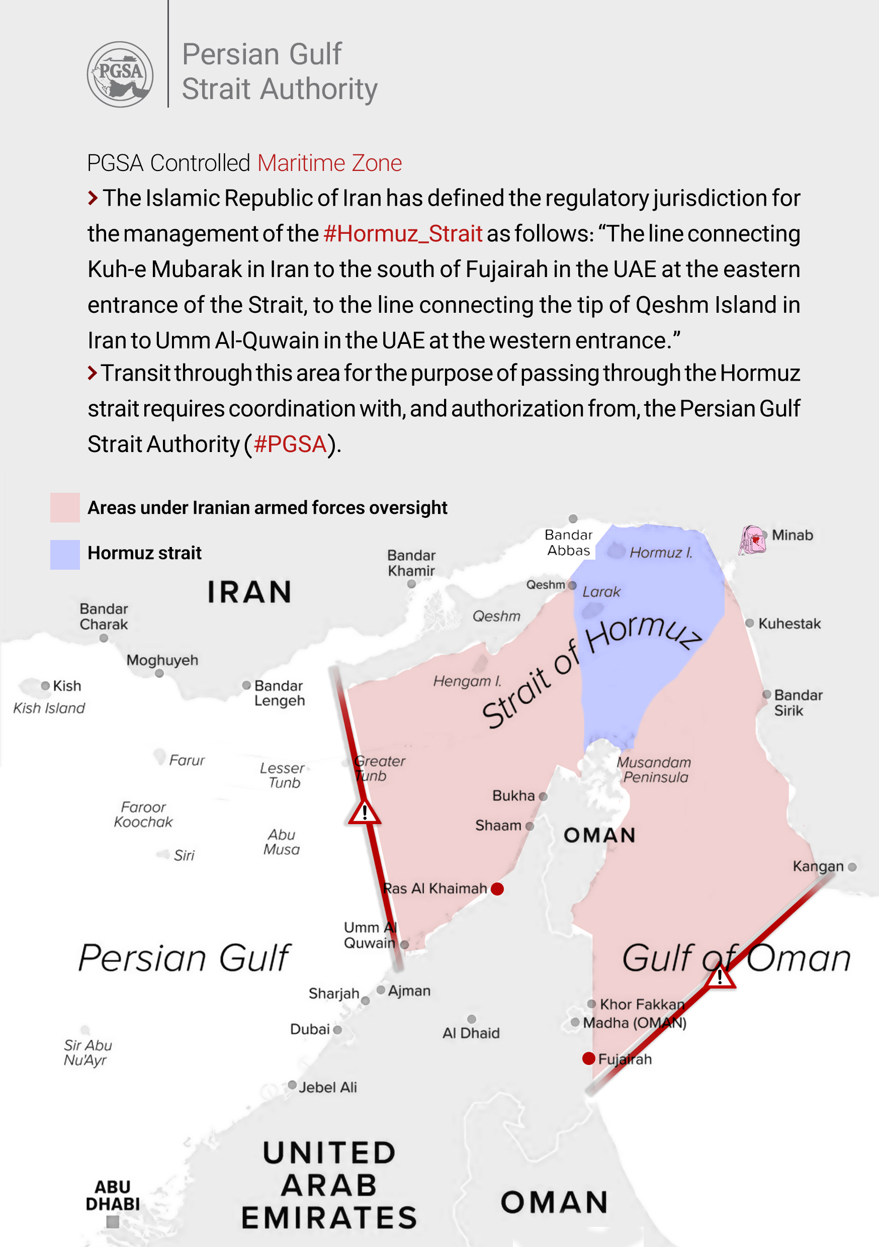
In a statement, the authority, set up to oversee the strategic waterway, defined the zone as extending “from the line connecting Kuh-e Mobarak in Iran and southern Fujairah in the UAE on the eastern side of the strait, to the line connecting the end of Qeshm Island in Iran and Umm Al Quwain in the UAE on the western side.”
1/
جمهورى اسلامى ايران محدودهٔ نظارتى مديریت تنگه هرمز را به این شرح تعيین کرده است: «خط اتصال كوه مبارك درايران وجنوب فجيره درامارات در شرق تنگه تاخط اتصال انتهاى جزيره قشم درايران و ام القيوین امارات درغرب تنگه.» pic.twitter.com/3ELSwYx5Bp— PGSA | نهاد مدیریت آبراه خلیج فارس (@PGSA_IRAN) May 20, 2026
It added that vessels transiting the area through the strait would be required to coordinate with and obtain authorization from the authority.
@E.Y.M